Back to gallery
a13-exposure-map · P1, P3, P5, P7
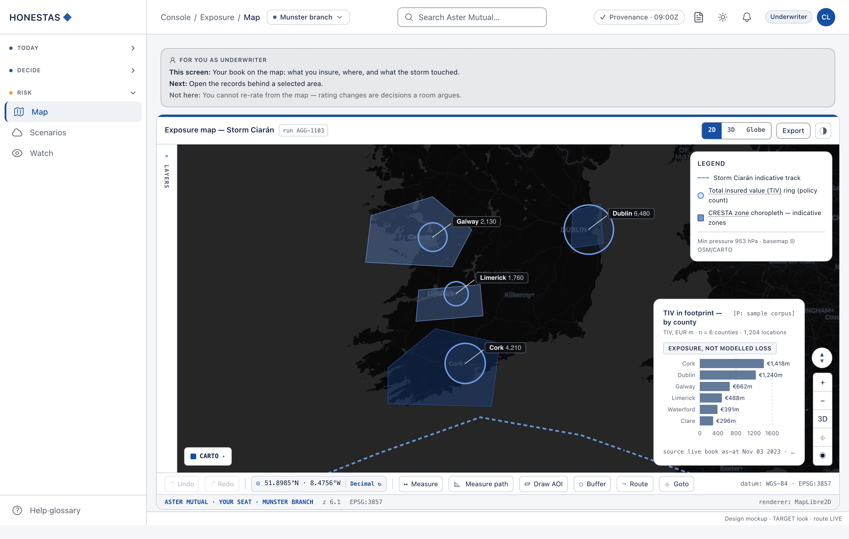
Exposure map
The exposure map on real MapLibre tiles over a sovereign CARTO basemap, with the CRESTA zone choropleth, TIV rings at real county coordinates, and the Storm Ciarán indicative track drawn together.
What you would do here: Open the records behind a selected area.
- Role
- Underwriter
- Industry
- General insurance (P&C)Specialty & LondonLife & healthReinsuranceBrokers & MGAClaims cycle timeLoss ratioCompliance evidenceCAT readinessFraudDeployment readiness
- Route
- /console/map
Design mockup, built from the real HONESTAS console components — TARGET look, not today's app.honestas.ai styling. Fixture data visible on the screen (organisation and person names) is illustrative — never a real customer. honestas-research/mockups/src/cases/a13-exposure-map.tsx